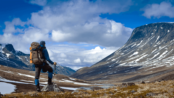
Stretching around 480 km, the Leh Manali Highway pass through rugged barren hills, deprived of signs of life and desolate, unending high altitude plateau. This route is certainly a treat for drivers who seek pleasure in driving on to rough treks which test the limits of both man and machine. The scenic beauty along the road is just spectacular and out of the world. The road has been opened up for civil traffic since 1989. While travelling on this highway, you will pass through one of the world’s highest grass-lands and semi desert plains of Changthang. However, you might still find a few shepherds and will almost certainly sight wildlife like Asiatic wild ass, wild sheep etc.
Accessibility
The road remains open for a short duration that is from June to September ending or longer if weather permits. Although, you may take a detour of Tsokar and Tsomoriri lakes, but mind it, these two are restricted areas and hence you need to have inner line permit that can be arrange only from a registered tour operator from Leh.
Manali-Keylong (110km) via Rohtang pass
Manali (1829m) is the usual starting point for the journey. It takes a good 3 hours climb to reach Rohtang pass(3978), which is 51 km away. The road is pretty bad at some stretches. You are advised to start early to avoid the usual rush hour of domestic traffic making daytrip to the pass. Rohtang notoriously means heap of dead also it means the end of habitable world. Throughout the stretch, you will find tiny beautiful hamlets as well as small restaurant along the road. As you cross Rohtang pass the road descends, and you can have the first glimpse of Lahaul-Spiti valley. In Khoksar(3141m), a village 19 km away from Rohtang, you will be asked for your passport at the police check post. This place has a few tiny dhabas and a rest house. Here you cross the Chandra river and going further about 40 km, passing some hamlets, you cross the Bhaga river at Tandi before reaching Keylong.
Keylong-Sarchu(103km): From Keylong the road follows the Bhaga river upstream passing through few villages. After 21 km at Jispa and further about 10 km you will reach Darcha(3360m), the last village of Himachal Pradesh. The landscape now turns more typical Trans-Himalayan with dry and barren highland. At Darcha there is a twin bridge crossing the Bassi stream and on either side of the bridges there are some tourist related amenities like camps or tented accommodations, restaurants and checkpost. Before Baralacha pass you may come across many petty tea shops including one at Patseo and Zingzingbar(4170km). A small and beautiful lake called Suraj Taal amidst the rugged terrain is a respite. You will then reach the Baralacaha la(4890m), which forms the watershed between the Indus and the Chenab, and you have crossed one of the ranges of the great Himalaya. A break here to enjoy the contrastingly colourful natural landscape is worth it. Further about 33 km from the pass, you reach Serchu(4253) on the bank of Lingti river.
Serchu to Leh(220km): About 25 km from Serchu, after a steep climb with as many as 20 bend you cross Nakee la(4800m). Further travelling 29km from here, you reach Lachulang la(5059m). The entire stretch upto this point from Serchu is quite arduous. The stretch beyond these passes offers some amazingly magnificent natural landscape. The serrated cliff faces, creating mud cones like a termite mounds, are spectacular natural architectural master pieces. After 25 km travel, you reach a beautiful and small valley called Pang(4450m). The spot is traditionally a place for lunch. Pang has a number of tented accommodation and restaurants. It also has a check post for the travelers. Further ahead, there is another 60 km stretch of wild road, up to Taglang la(5253m), which is second highest motorable road in the world. The part of road is rough, strangely monotonous with no habitation. The descent from Taglang la inspiringly, shows human habitation once again and you will follow the small stream through a narrow valley to enter the grand valley of Indus. From Taglang la it is 60 km to upshi which passes through hamlets of Gya and Rumste. The road then crosses the river Indus to reach a tri junction of Upshi. At Upshi there is another check point for tolls and inner line permits for those heading to Changthang. To the right is the road to Changthang while to the west along the Indus is the road to Leh. The next and final drive of about 50 km stretch is straight and easy. The first major village along the road is Thiksey. The monastery perched on a hill top reminds you of Potala palace,Tibet. Next village is the Shey, Choglamsar and finally a gradual climb to enter into Leh.
Send us query
We will revert in 1hrs
Plan Your Travel
Top Trending Tours
-

Bike Group tour Manali ladakh manali
Why travel with Ladakh Motor Bike group Tour Ex Ma...
Read More -
-

Ladakh Delight with Siachen flight included
We welcome you to explore Ladakh Region knowing y...
Read More -

Ladakh Kashmir Manali bike trip Siachen base
Small group motorcycle tours operator since 2014 ...
Read More -
Manali Ladakh Srinagar with tsomoriri & Hanle
Welcome Manali -Srinagar Bike small group trip , t...
Read More